
From project kickoff, our team of professionals carefully analyzes each process and the technology used in every assignment. With each iteration, we apply incremental improvements, ensuring high-level services with maximum efficiency and unmatched turnaround times.
Registering, Cleaning, and Preprocessing
Scan Registration and Alignment
Filtering and Noise Reduction
Data Segmentation and Classification
Normalization and Precise Georeferencing
Conversion to CAD/BIM Formats
Digital Terrain Modeling (DTM)
Reconocimiento Automático de Elementos
3D Geometry and Mesh Extraction
Automatic Feature Recognition
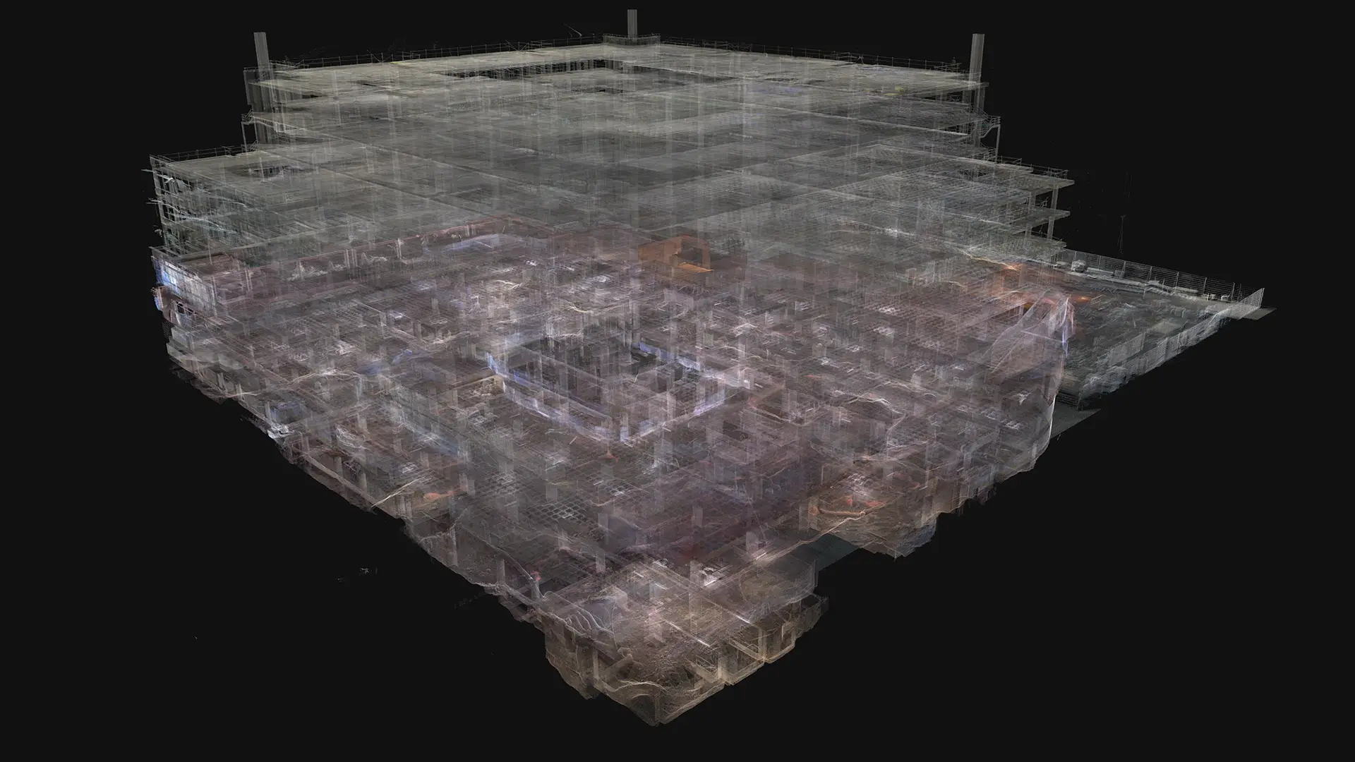
As-Built Modeling for Architecture & Engineering
2D CAD Drawings from Point Clouds
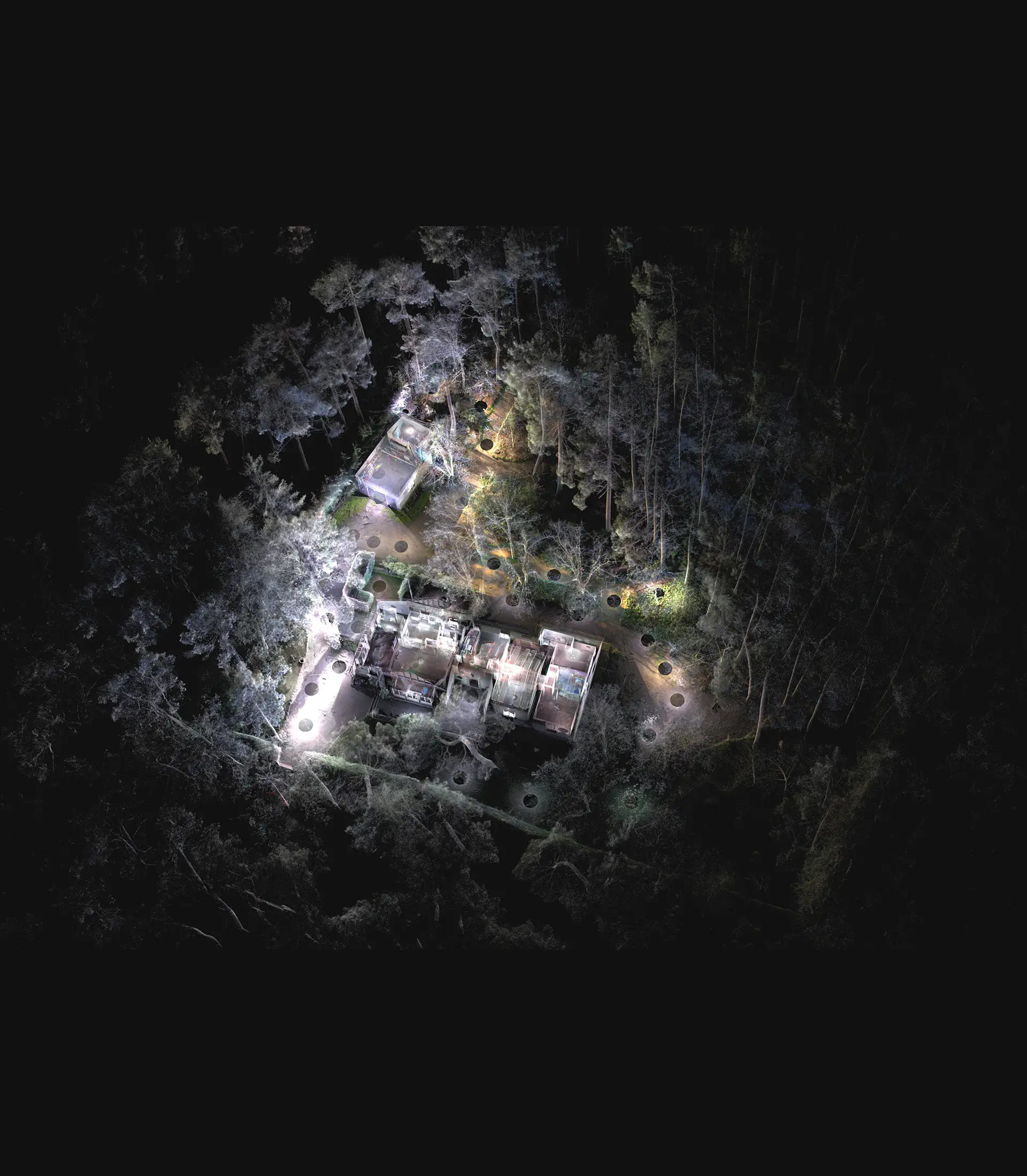
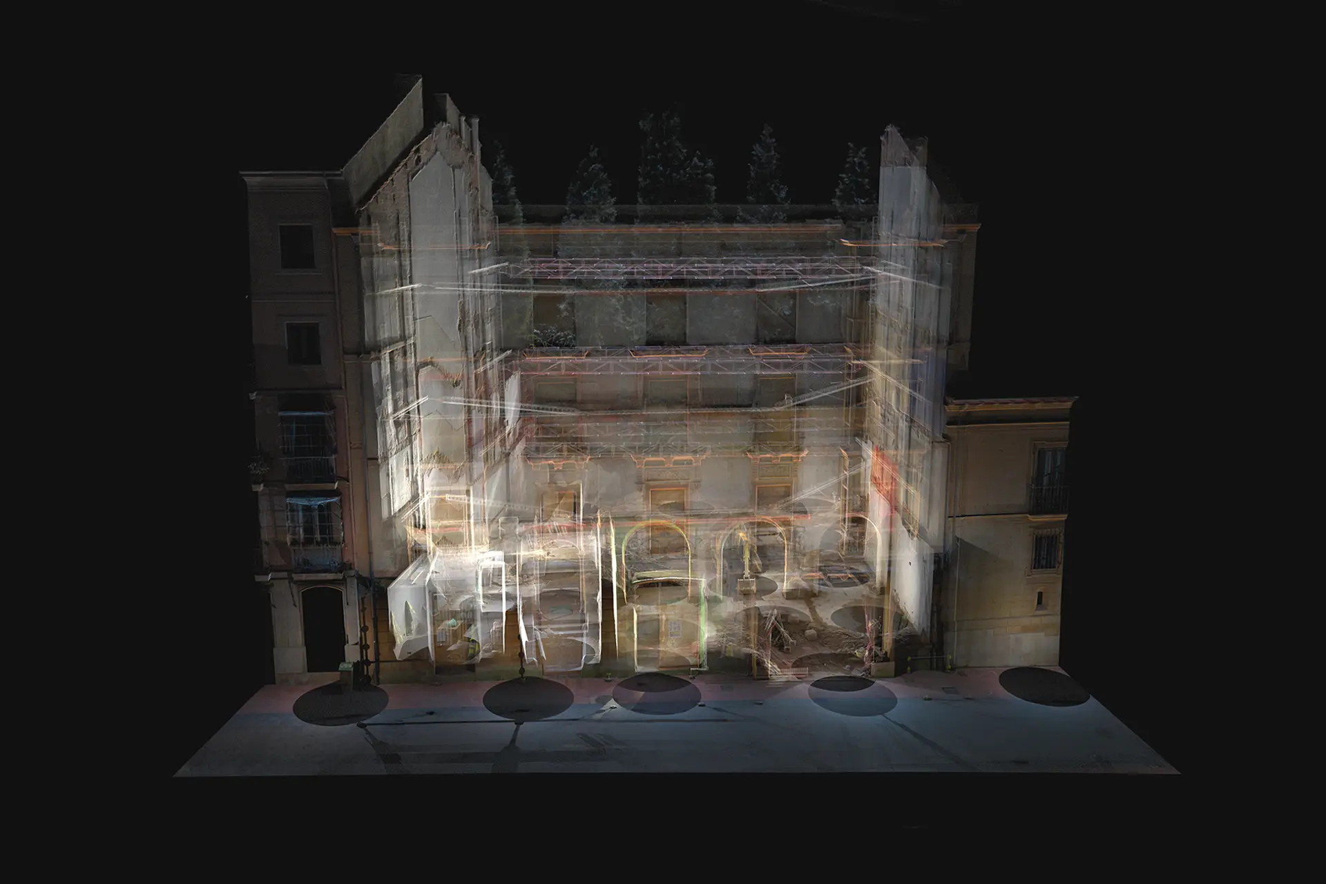
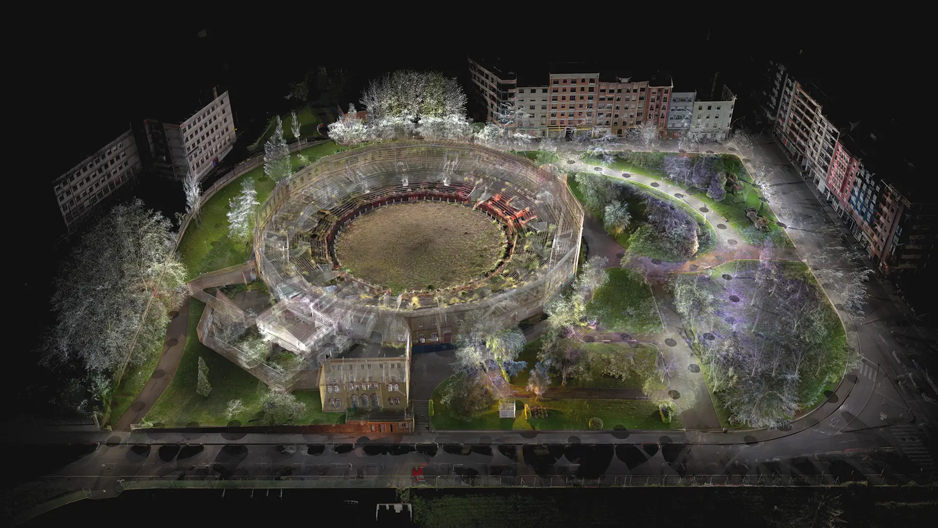
Heritage Digitization & Restoration
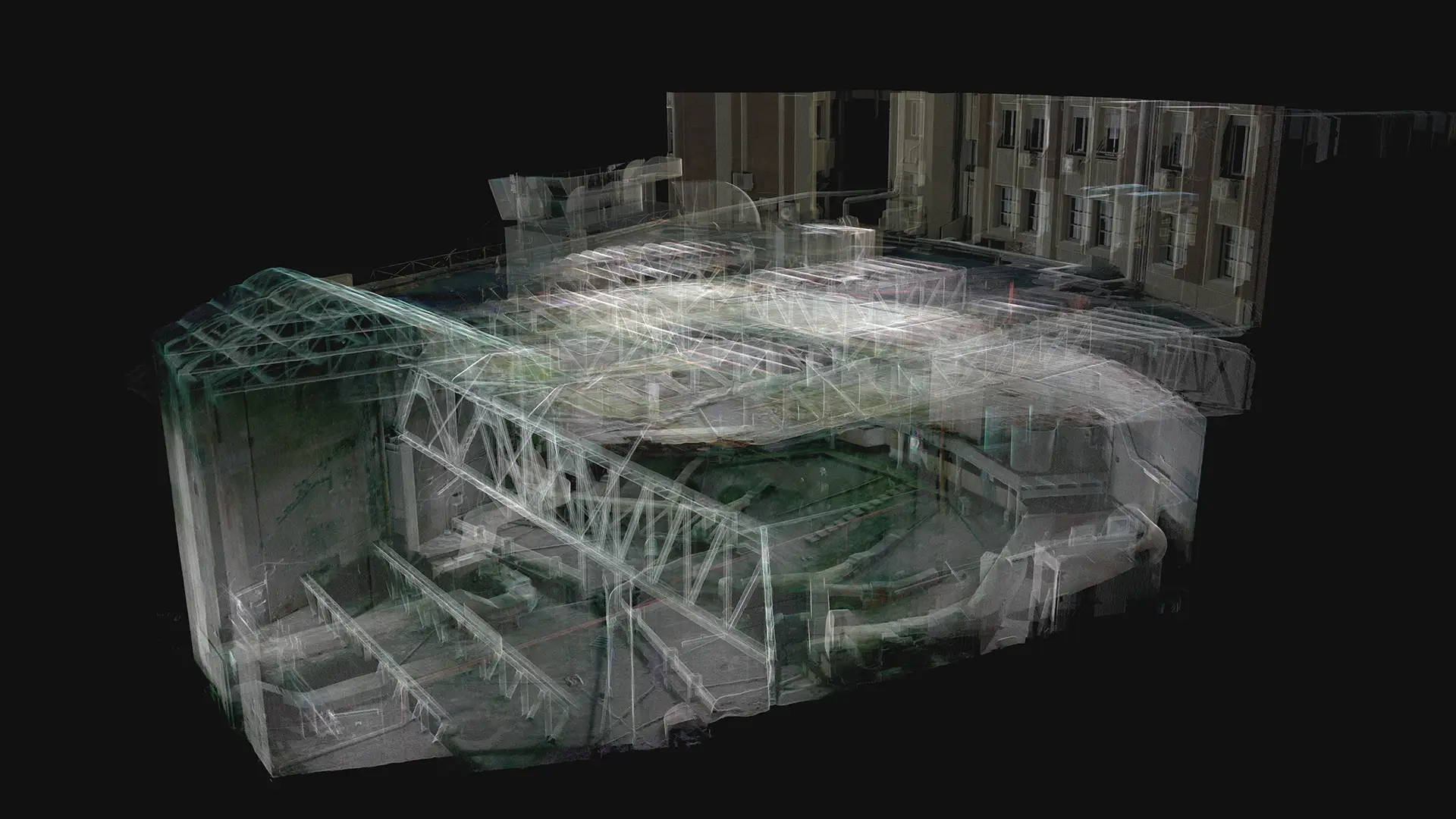
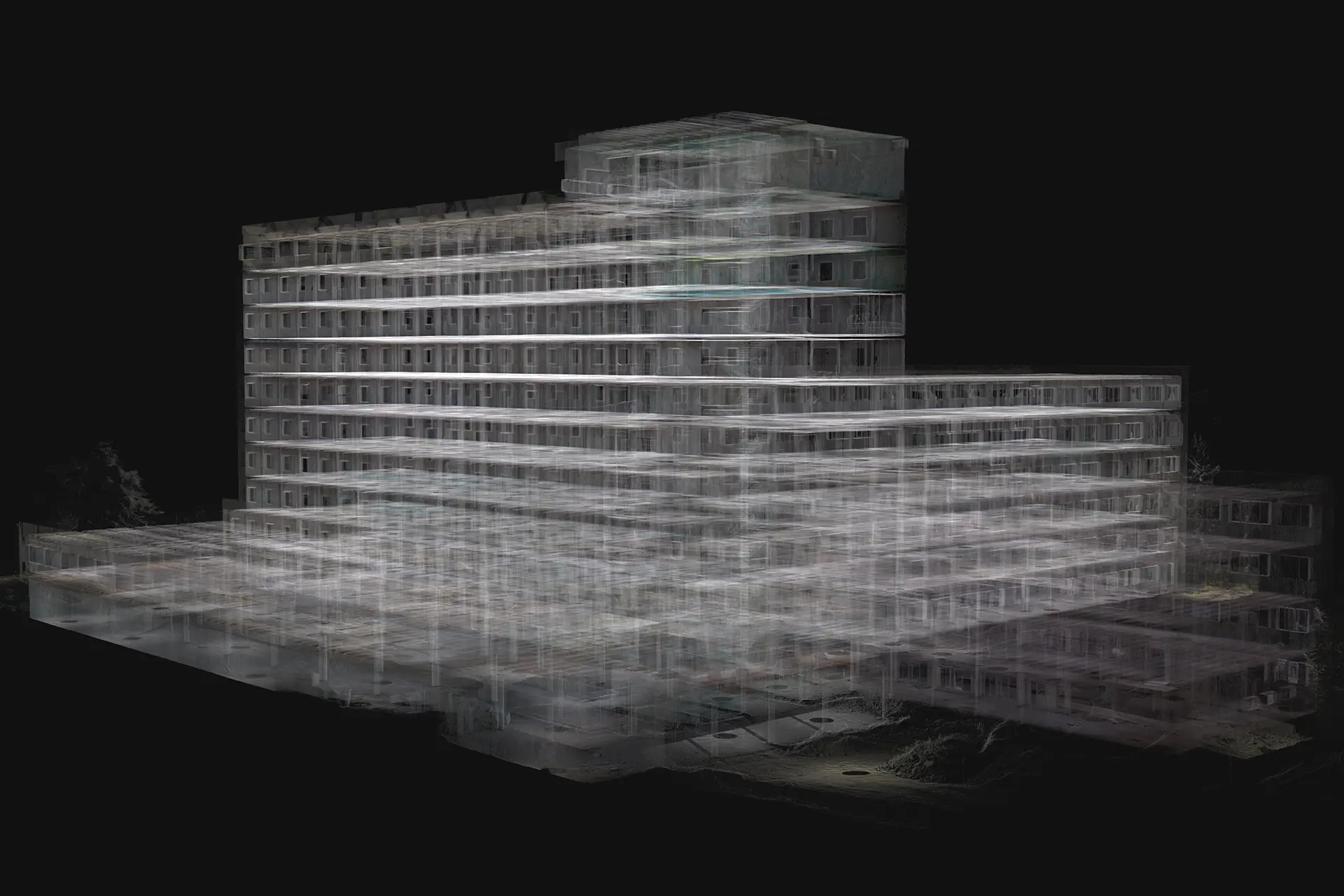
Infrastructure Inspection & Monitoring
Point clouds simplify the accurate documentation of historic buildings and archaeological sites, capturing every detail without physical contact. This technology enables the creation of highly precise 3D models, essential for restoration, structural analysis, and long-term preservation
Additionally, laser scanning and photogrammetry help detect deformations, assess structural conditions, and plan interventions with greater accuracy.
3D laser scanning precisely captures building geometry, making structural consolidation, reinforcement, and retrofitting more efficient. The point cloud provides an accurate foundation for interventions, eliminating errors.
It also helps identify deformations, detect structural issues, and assess shifts, allowing for better planning of reinforcements and renovations with exceptional precision.
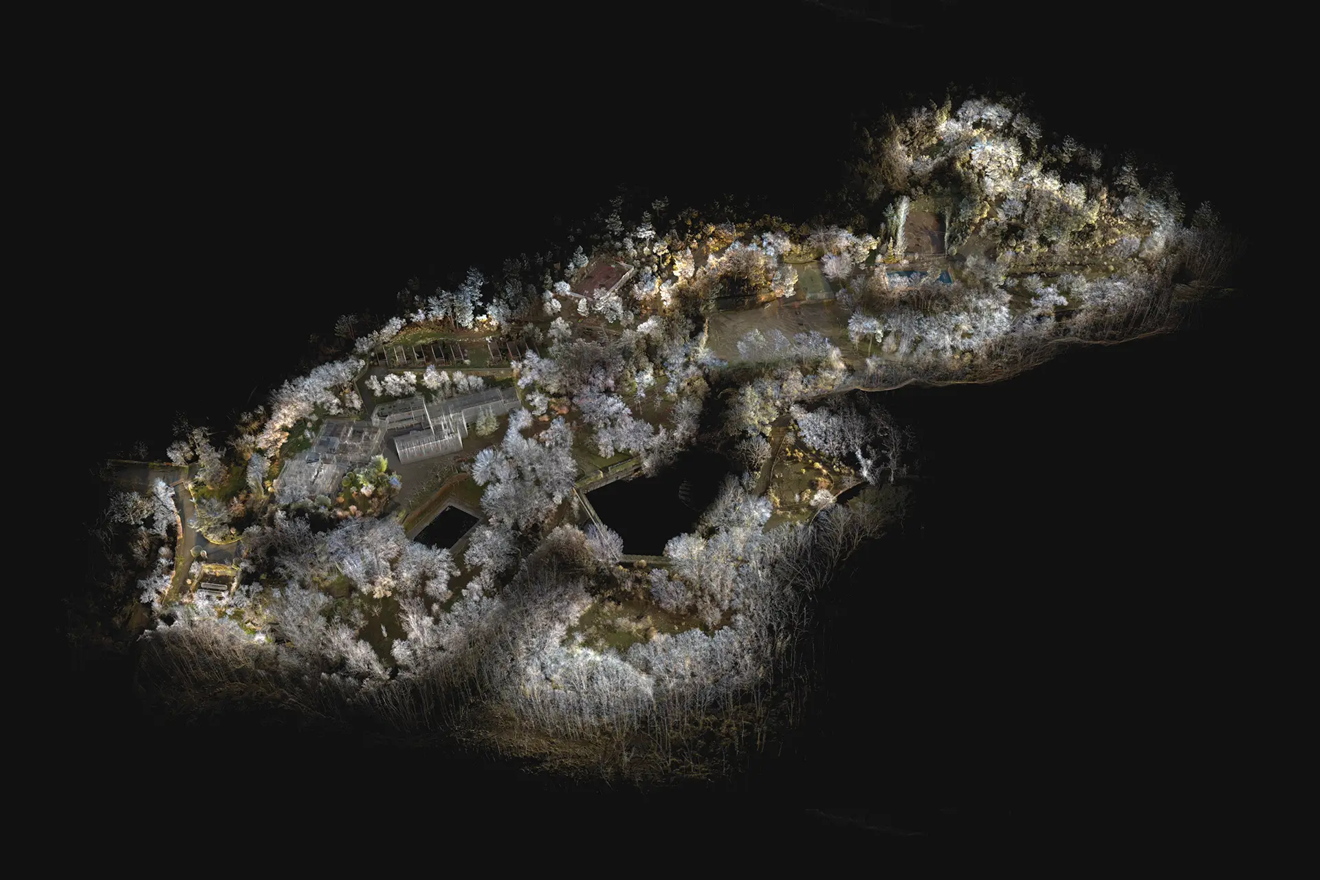
Drones and laser scanners provide fast, precise mapping of large areas, generating high-density point clouds for topographic surveys and land assessments.
Their speed and detail improve geospatial analysis, terrain modeling, and infrastructure monitoring, optimizing large-scale project planning and progress tracking.
3D laser scanning and aerial photogrammetry provide precise geometric records of infrastructure like substations, solar farms, dams, and bridges.
High-density point clouds support diagnostics, maintenance, and conservation, making asset management more efficient.
This technology simplifies the detection of structural issues, tracking of deformations, and monitoring of ground shifts, leading to better intervention planning. It also enhances heritage and operational management, improving strategic decision-making.
Puente la Reina 35, 28050 Madrid
+34 675 828 425
